Mesa Falls
- Height
- 114 ft
- Hike
- 1 mi each way
- Road
- Paved
- Permit
- Not required
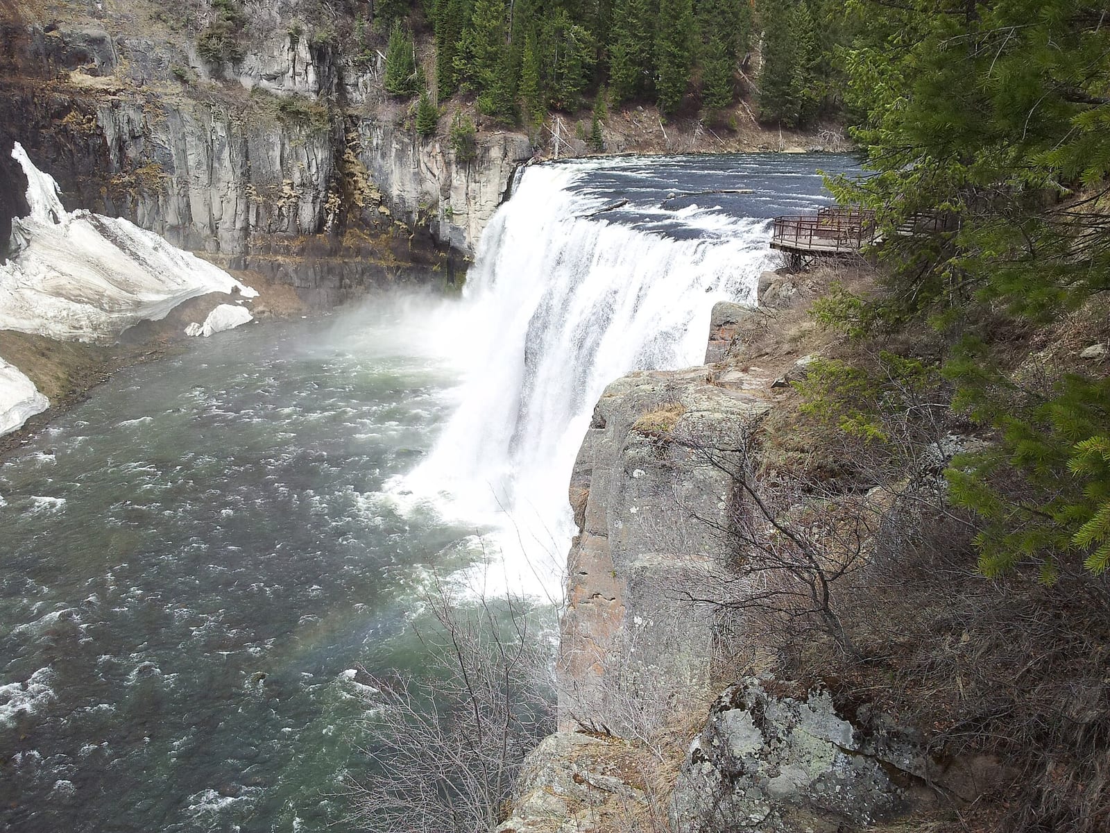
Mesa Falls drops about 114 ft on Henrys Fork of the Snake River in Fremont County, Idaho. Reaching it is a 1 mi hike each way.
Closures and warnings
Stay out of closed construction zones. Citations issued for driving or walking past barricades. Cliffs and river currents are hazardous when sites reopen. As of September 28, 2026.
The falls
| Height | 114 ft |
|---|---|
| Flow note | Upper Mesa Falls about 114 ft; Lower Mesa Falls about 65 ft farther downstream on Henrys Fork. |
| Swimming allowed | No |
|---|---|
| Jumping | Prohibited |
| Current | Strong |
Access
| Hike | 1 mi each way |
|---|---|
| Road | Paved |
| Road note | Mesa Falls Scenic Byway (Highway 47 / FS routes) between Ashton and Island Park; upper area roads may close in winter for snow recreation. |
| Parking | Upper Mesa Falls Visitor Center / Big Falls Inn lot and Lower Mesa Falls Grandview overlook lot when open. |
| Fee | Upper Mesa Falls day-use: $5 per vehicle / $1 walk-bike-horse / $25 tour bus when open. America the Beautiful and. |
| Reservation or permit | Not required |
| Seasonal closure | Temporary closures at Upper and Lower Mesa Falls remain in effect for construction (road, trail paving, boardwalk). USFS updated Sep 16, 2026; contact Ashton/Island Park RD 208-652-7442. |
| Wheelchair access | Accessible overlooks and paved paths planned; confirm status after construction. |
| Managed by | USDA Forest Service (Caribou-Targhee National Forest, Ashton/Island Park Ranger District) |
| Restrooms | Yes |
|---|---|
| Picnic sites | Yes |
| Note | Mesa Falls Visitor Center in historic Big Falls Inn when open. |
Common questions
Common questions
Is Mesa Falls open?
Stay out of closed construction zones. Citations issued for driving or walking past barricades. Cliffs and river currents are hazardous when sites reopen. As of September 28, 2026. Seasonal closure: Temporary closures at Upper and Lower Mesa Falls remain in effect for construction (road, trail paving, boardwalk). USFS updated Sep 16, 2026; contact Ashton/Island Park RD 208-652-7442.
How tall is Mesa Falls?
Mesa Falls drops about 114 ft.
Can you swim at Mesa Falls?
No, swimming is not allowed at Mesa Falls. A strong current is reported here, use caution.
How long is the hike to Mesa Falls?
It's a 1 mi hike each way. The road in is paved. Mesa Falls Scenic Byway (Highway 47 / FS routes) between Ashton and Island Park; upper area roads may close in winter for snow recreation. Parking: Upper Mesa Falls Visitor Center / Big Falls Inn lot and Lower Mesa Falls Grandview overlook lot when open.
Do you need a reservation for Mesa Falls?
No reservation or permit is required.
Is there a fee at Mesa Falls?
The fee is Upper Mesa Falls day-use: $5 per vehicle / $1 walk-bike-horse / $25 tour bus when open. America the Beautiful and.
When is Mesa Falls flowing?
Upper Mesa Falls about 114 ft; Lower Mesa Falls about 65 ft farther downstream on Henrys Fork.
Nearby
Sources
5
- https://www.fs.usda.gov/r04/caribou-targhee/recreation/mesa-falls-visitor-center (accessed September 28, 2026; backs manager / access.fee / amenities visitor center, access.hikeDistanceMi nature trail to Lower / swimmingAllowed false)
- https://www.fs.usda.gov/r04/caribou-targhee/newsroom/releases/closures-mesa-falls-remain-effect-public-safety (accessed September 28, 2026; backs access.seasonalClosure / hazardNote construction)
- https://www.travelrealizations.com/mesa-falls-yellowstone-national-park/ (accessed September 28, 2026; backs waterfall.heightFt Upper / Lower / waterbodyName)
- https://decorhint.com/before-driving-to-this-idaho-waterfall-this-fall-know-the-road-closes-for-winter-f08a8320/ (accessed September 28, 2026; backs access.roadNote winter closure context)
- https://www.eastidahonews.com/2026/09/stay-out-forest-service-warns-visitors-after-vehicles-drive-past-mesa-falls-closures/ (accessed September 28, 2026; backs waterfall.flowNote)
More: Idaho waterfalls