Potem Falls
- Height
- 65 ft
- Hike
- 0.3 mi each way
- Road
- High clearance
- Permit
- Not required
- Dogs
- Allowed
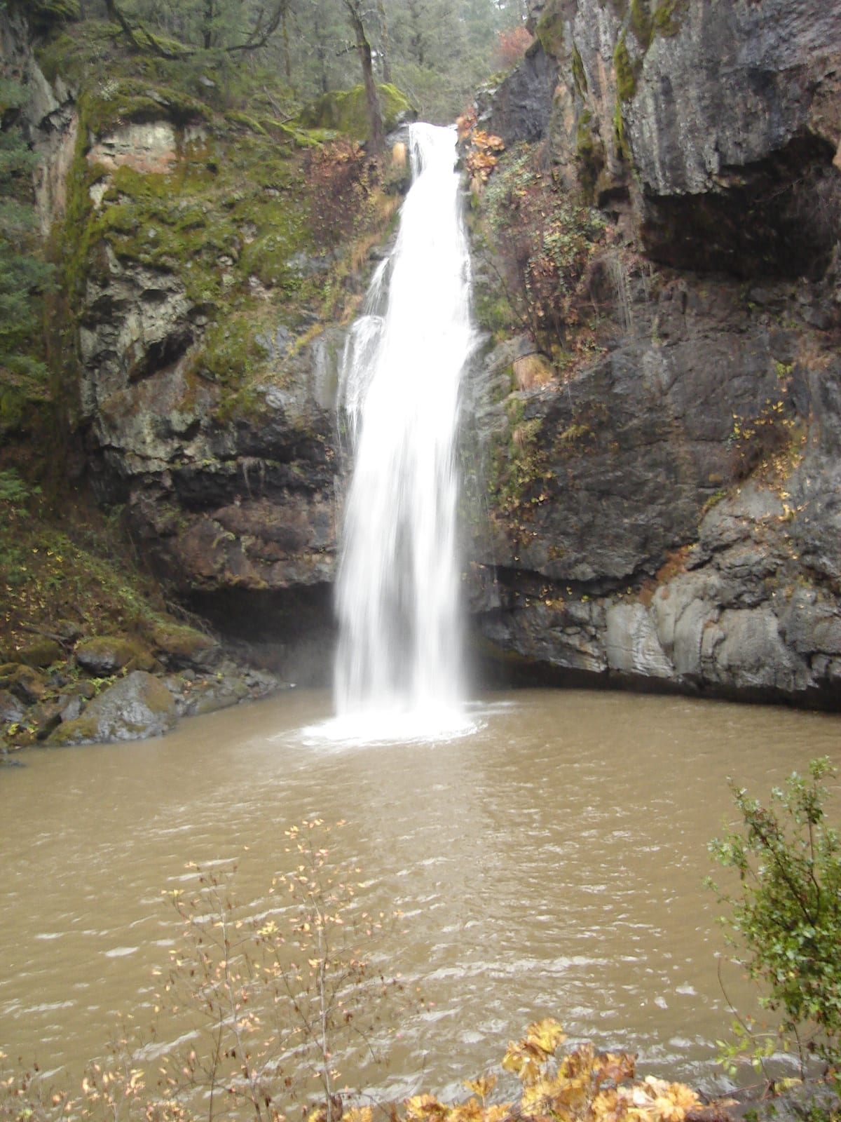
Potem Falls flows year-round. Potem Falls is a 65 ft waterfall on Potem Creek in Shasta County, California. Reaching it is a 0.3 mi hike each way.
Closures and warnings
USFS: trail is rocky with steep drop-offs; rattlesnakes and poison oak possible. No developed facilities or drinking water. Rocks are slick when wet. As of September 30, 2026.
The falls
| Height | 65 ft |
|---|---|
| Flows | year-round |
| Flow note | USFS: year-round waterfall on Potem Creek. World Waterfall Database lidar indicates about 65 ft; USFS trail page publishes 70 ft. |
| Water type | Waterfall basin |
|---|
Access
| Hike | 0.3 mi each way |
|---|---|
| Road | High clearance |
| Road note | From Hwy 299, Fenders Ferry Road (Road 27): about 9 miles to the pullout. Dirt road; USFS recommends four-wheel drive or high-clearance. Allow about 30 minutes for the drive. |
| Parking | Dirt pullout parking on Fenders Ferry Road (very limited; USFS suggests carpooling and weekday or spring/fall visits). |
| Fee | No fee |
| Hours | Trail open year-round; USFS recommends spring and fall for Shasta Lake area trails (severe summer heat, no drinking water on trail). |
| Reservation or permit | Not required |
| Managed by | USDA Forest Service, Shasta-Trinity National Forest |
Rules
| Dogs | Allowed |
|---|
Common questions
Common questions
Is Potem Falls open?
USFS: trail is rocky with steep drop-offs; rattlesnakes and poison oak possible. No developed facilities or drinking water. Rocks are slick when wet. As of September 30, 2026. Hours: Trail open year-round; USFS recommends spring and fall for Shasta Lake area trails (severe summer heat, no drinking water on trail).
How tall is Potem Falls?
Potem Falls drops about 65 ft.
How long is the hike to Potem Falls?
It's a 0.3 mi hike each way. The road in is high clearance. From Hwy 299, Fenders Ferry Road (Road 27): about 9 miles to the pullout. Dirt road; USFS recommends four-wheel drive or high-clearance. Allow about 30 minutes for the drive. Parking: Dirt pullout parking on Fenders Ferry Road (very limited; USFS suggests carpooling and weekday or spring/fall visits).
Do you need a reservation for Potem Falls?
No reservation or permit is required.
Is there a fee at Potem Falls?
Yes. No fee.
When is Potem Falls flowing?
It flows year-round. USFS: year-round waterfall on Potem Creek. World Waterfall Database lidar indicates about 65 ft; USFS trail page publishes 70 ft.
What are the rules at Potem Falls?
Dogs are allowed.
Nearby
Camping nearby
Public land
Potem Falls is inside Shasta-Trinity National Forest .
Sources
4
- https://www.fs.usda.gov/r05/shasta-trinity/recreation/trails/potem-falls-trail (accessed September 30, 2026; backs manager, access.roadSurface / access.roadNote, access.parking, access.fee, hazardNote, access.hikeDistanceMi / access.hikeDistanceBasis, access.hours, rules.dogs, waterfall.heightFt / waterfall.flowNote, waterfall.flowMonths / waterfall.flowNote)
- https://edits.nationalmap.gov/apps/gaz-domestic/public/search/names/264998 (accessed September 28, 2026; backs waterbodyName)
- https://www.yiftahshahar.com/2021/11/potem-creek-falls-shasta-trinity.html (accessed September 28, 2026; backs access.permitRequired, swimmerNotes.waterType)
- https://www.worldwaterfalldatabase.com/waterfall/Potem-Falls-6830 (accessed September 30, 2026; backs waterfall.heightFt)
More: California waterfalls